There may be no better examples of the curious Aussie tendency to seemingly mispronounce and misspell every possible place name than Boonoo Boonoo National Park and Undercliffe Falls. Located just over the border from Queensland in northeastern New South Wales, Boonoo Boonoo (or “bunna bu-noo,” from a local Aboriginal term for “big rocks”) and Undercliffe Falls both make excellent day trips from the nearby town of Stanthorpe (population approx. 6,000).
Located in the heart of Queensland’s Granite Belt, Stanthorpe (which literally means “tin town” – “stannum” is Latin for “tin,” while “thorpe” is Middle English for “village”) is a haven for backpackers looking to become eligible for a 2nd year working holiday visa (WHV). Allan Cunningham became the first European to settle around Stanthorpe (then Stannum/Quart Pot Creek) in 1827, but the area remained a lonely outpost until an influx of tin miners in the early 1870’s. Though tin prices fell by the time the railway arrived just over a decade later, a lasting local legacy began in the late 1860’s when a priest of Italian descent began cultivating grapes for altar wine. Because of Stanthorpe’s relatively cool, dry climate (at an elevation of 811 m above sea level, Queensland’s coldest temperature of -10.6 C was recorded here in the winter of 1961), a variety of fruits and vegetables thrive in the soil – capsicum, apples, stone fruit and, most importantly, grapes.
Today, the region teems with wineries, farms, travelers, tourists and national parks. So if you find yourself in Stanthorpe picking for your 88 days and manage to get a break amidst 21 consecutive 14-16 hour days in the fields (only slight hyperbole with this one), be sure to pack some drinks and food, a camera, some trunks and don’t forget to “slip, slap, slop” on your way to these beautiful spots.
Boonoo Boonoo National Park

Boonoo Boonoo is a place for lovers, or so the story goes. In 1903, poet Andrew “Banjo” Patterson took Alice Walker, daughter of the owner of Tenterfield cattle station, out to the falls and proposed to her. To everyone’s surprise she said yes, and the park’s reputation as a romantic getaway became part of local folklore.
The falls first became accessible at the turn of the 19th century after the discovery of gold. For a brief spell Boonoo Boonoo village thrived as panners worked Morgans Gully and Ropers Gully – the remains of which can still be visited within the park. The village and the gold were abandoned long ago, but Boonoo Boonoo remains a draw to this day.
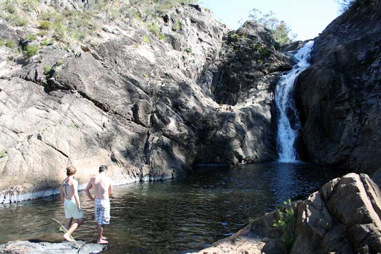
In 1964, a request was put in to make the area around the falls a national park, and it was approved in 1982. The 1,345 hectares that originally constituted the parklands has since grown to 4,377 hectares of scenic New England tablelands. In addition to the falls, where the Boonoo Boonoo River cascades over granite cliffs before plunging 210 meters into a vast gorge below (a great view of which is available from a lookout point a short walk from the car park), Boonoo Boonoo NP has Eucalyptus forests, graded hiking tracks, shady picnic areas, wildflowers, rock pools, mountain biking, fishing, swimming, barbecue facilities, campgrounds (15 of them at $10/night per adult, $5/per child) and cabins (2 bedrooms for up to 6 people at $115 per night; minimum 2 night stay, book online in advance).
Predictably, the park is abound in wild fauna as well. Birds, brush-tailed rock and red-necked wallabies, possums, wallaroos, kangaroos, dragon lizards, skinks, and brown and red-bellied black snakes basking on the rocks could make a cameo during your visit if you look hard enough.
Undercliffe Falls

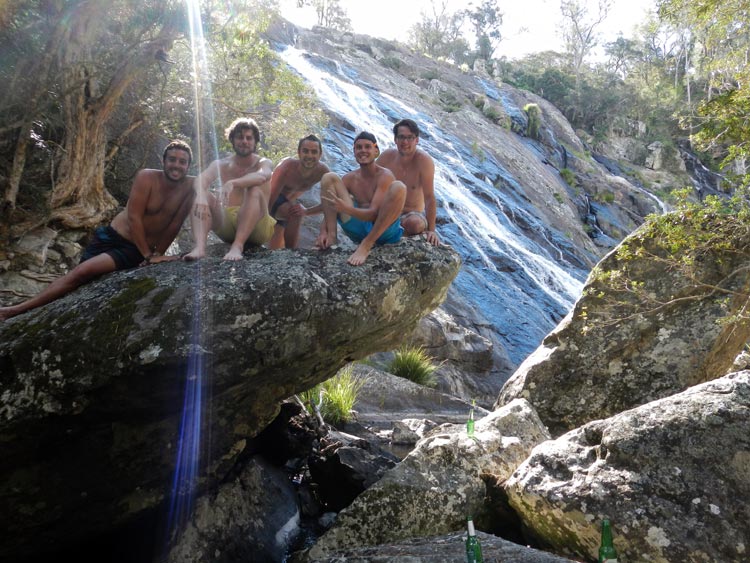
A bit more off the well-beaten path than Boonoo Boonoo is Undercliffe Falls. Located in the community of Tenterfield Shire just outside the village of Liston and a short drive over the Queensland border into NSW, the falls flow from the (undoubtedly hysterically pronounced) Bookookoorara Creek and down a relatively flat rock face 140-160 meters tall and 30 meters wide into a deep pool that’s ideal for swimming on those hot Australian days. Flowing northeast from near Bald Rock National Park, the creek turns east before dropping down the side of a valley and running due south before going over the cliff’s edge.
Undercliffe Falls isn’t a national park, as the lack of campgrounds, facilities and self-registration reflect. Good walking shoes are recommended for the somewhat perilous walk down to the bottom. A trail takes visitors through towering Eucalyptus trees and to a state forest, with the circuit returning back to the creek and falls afterwards.
How to get to Boonoo Boonoo National Park and Undercliffe Falls
The two closest towns to the aforementioned spots are Tenterfield in NSW and Stanthorpe in QLD. From Stanthorpe (220 km/2.5-3 hrs. drive southwest from the QLD capital Brisbane), take Amosfield Road for both destinations. For Boonoo Boonoo, follow the signs for Balk Rock National Park (the roads turn to dirt and are lined with kangaroos as you approach the park, drive with caution). Travel past the Bald Rock turnoff and continue for 5 kilometers. From here, follow the signs for Boonoo Boonoo NP. The park is open year-round, save for in times of poor weather or fire danger. It costs $7/day to enter the park per vehicle, and a self-registration system applies.
For Undercliffe Falls, take the same road (Amosfield) you would towards Boonoo Boonoo but at the fork in the road where you turn right to continue towards Bald Rock/Boonoo Boonoo, turn left and head towards Liston. There, take a right on Rivertree. At the next fork in the road, veer left and continue 4 kilometers. Take another right turn and you’ll see a sign posted for the falls. Entrance is free, and there’s a car park at the end of the road before the walking track to the falls.
If you’ve got some more time in the Stanthorpe area, there are over 50 wineries and myriad national parks in the area, including Boonoo Boonoo, Bald Rock, Girraween and Sundown. There are several hotels, B&B’s and caravan parks around and they should be able to point you towards where you want to go. If all else fails, head to the Stanthorpe library where you can get a map of the area and help from one of the friendly librarians.
Photos courtesy of Ruben Cardoso, Raphael Lefebvre and Jerry Gensollen; Philip and Anname
Make your next trip the best one.
Departful is a full service travel agency creating truly exceptional travel experiences that are 100% personalized to you. Wherever you’re going, whatever your interests, we help you plan the perfect trip.
Alex Rathy
Alex is a writer, ESL teacher, baseball enthusiast and Hunter S. Thompson fanatic currently based in Sydney, Australia. He has previously lived in Canada, the U.S., South Korea and China and has traveled extensively throughout Asia. He enjoys hiking, spicy food, dance parties in the jungle, questionable hairdos, Vonnegut novels and has been known to appreciate a good hammock on occasion.


