Much to the chagrin of its most ardent supporters – and even more sadly for those of us who take considerable joy in cracking jokes about the extreme dorkiness of the national character – it turns out that StarCraft is actually NOT the official national sport of South Korea. That distinction belongs to the martial art taekwondo (태권도), which loosely translates as “the way of the hand and the foot” and that, I think you will agree, sounds considerably more badass than “the way of the index finger and the mouse.” But while taekwondo has gained considerable traction at home since its inception in the 1940s, there is without a doubt no single physical activity more interwoven into the fabric of Korean society than hiking.
A simple 360° turn from almost any point south of the DMZ should be enough to explain why. Approximately 70% of the republic’s total area is classified as uplands or mountains, making the rolling green hills of the Taebaek and Sobaek ranges and Jiri Massif as ubiquitous to life here as snow in Siberia or sand in the Sahara. And even though thousands of years of erosion have left some of these “mountains” as little more than glorified bumps in the eyes of some, on any given day of the week without fail one can find anywhere from dozens to tens of thousands of hikers, invariably clad head-to-toe in colourful brand name outdoor gear and sporting walking sticks, conquering peaks and enjoying views at all elevations across the nation.
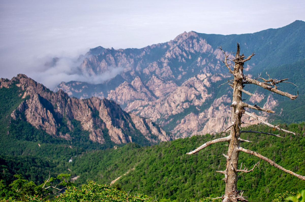
One particular mountain that has captured the imagination of Koreans for generations is Mt. Seorak (Seoraksan 설악산 – literally “Snowy Crags Mountain”) in northeastern Gangwon Province. Part of the aforementioned Taebaek range that makes up the backbone of the Korean peninsula, Mt. Seorak is the third tallest in South Korea and considered by many to be the most beautiful. Designated the country’s 5th national park in March 1970 and later named an official Biosphere Preservation District by UNESCO for its wide variety of plant and animal life, today the mountain attracts several million visitors annually. While the park can be divided into three sections – Inner, Outer, and South Seorak, all of which are worth visiting if you have the time – the rest of this article will focus solely on the hikes and spectacular sights of Outer Seorak, all of which are accessible from the Seorakdong Information Centre area.
Sinheungsa and the Great Unification Buddha (신흥사)
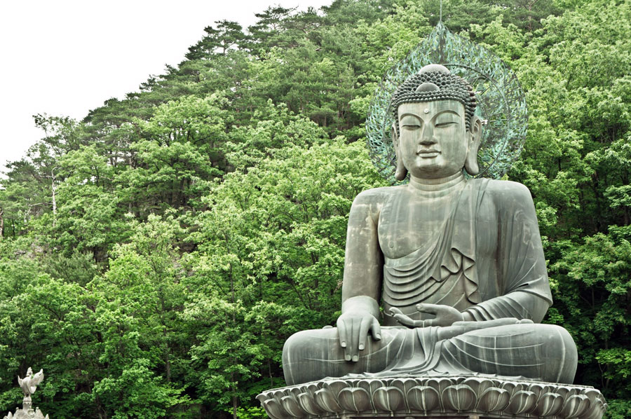
Just a short, flat 10-minute walk from the park’s entrance lies Sinheungsa, one of the head temples of the Jogye Order of Korean Buddhism. Originally built in 652 during the Silla Dynasty by a monk called Jajang, Sinheungsa is alleged to be the oldest Zen Buddhist temple in existence. Unfortunately, fires in 699 and 1648 destroyed the vast majority of the original buildings, meaning that most of what visitors see today has been rebuilt fairly recently. Near the temple’s entrance stands a 14.6-meter (48-foot) tall, 108-ton bronze Buddha statue known as Tongil Daebul. Sitting with legs crossed, eyes partially closed in meditation and sporting a faint smile, Tongil Daebul represents the wish of the Korean people that their divided homeland may one day be reunified.
Gwongeumseong Castle (권금성)
A few hundred meters before reaching Sinheungsa, visitors will find a station with cable cars that can whisk them most of the way up a rugged peak high above the Cheongbuldong Valley. Here lie the ruins of Gwongeumseong Castle, also known as Gwon-Kim Castle. While some believe that the fortress was built during the Goryeo Period by King Gojong, another legend has it that two generals (surnamed Gwon and Kim, as you may have guessed) had it built in order to avoid a bloody war. After the 20-minute cable car ride (cost 7,000 won, approx. $6.50 USD), a short hike and scramble (rope available) gets you to the summit. On clear days, the views of the nearby coastal city of Sokcho and East Sea (Sea of Japan) can be superb.
Biryong Waterfall (비룡폭포)
Starting at Biryonggyo Bridge just east of the cable car station, this easy 4.8 km round-trip hike begins by taking you on a wide, flat path eastward through a dense bamboo forest. About halfway into the trek the trail veers south, winding for the last few clicks gently upward past a series of cascades and shallow pools before arriving at the falls, which are nestled in a narrow ravine. It’s said by some that the falling water looks like a dragon rising up towards the heavens – biryong means “flying dragon” – but in the humble opinion of this author (and to paraphrase Marge Simpson): “Homer, you know I always try to put the best face on everything, but there’s no dragon in that damn waterfall!”
Ulsanbawi (울산바위)
Koreans love their folklore, as the story of Ulsanbawi (Ulsan rock) perfectly demonstrates. According to the tale, one day the mountain god decreed that all the most beautiful mountains on the peninsula must gather to build Mt. Kumgang (Kumgangsan 금강산 – “Diamond Mountain”), which stands just to the north of Mt. Seorak across the border in modern-day North Korea. Chosen to represent the Busan-Ulsan area of what is now southeastern South Korea, Ulsanbawi headed north but arrived too late; there was simply no room left at Mt. Kumgang. Ashamed, Ulsanbawi trudged slowly home, stopping to rest one night near Mt. Seorak. Upon waking the next morning, the rock was so enamored with the region’s beauty that it ultimately decided to stay.
The hike to Ulsanbawi begins near Sinheungsa, first going north for about 2 km along a well-beaten path. At this point many hikers stop at Heundelbawi, a large boulder resting upon a huge stone, and give it a mighty heave; although pushing the boulder in a certain direction will result in it moving and rocking a bit, no one has been able to push it over yet. From here, continue along the rocky path for another 1.8 km, and steel yourself for the final 800-step (exactly 888 according to locals) vertical climb to the top.
The Road to Daecheongbong (대청봉)
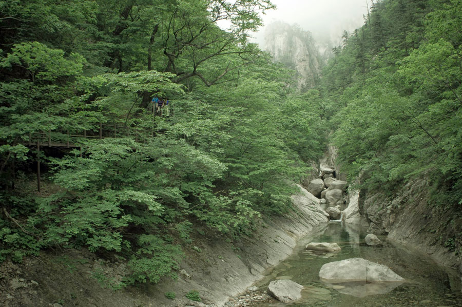
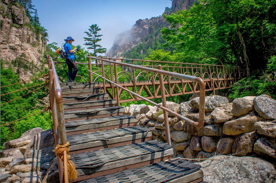
The ultimate challenge for daytrippers to Seoraksan is the hike to (not to mention back down from) Daecheongbong, the mountain’s highest peak. At well over 16 km return from the park’s entrance and reaching a height of 1,708 meters (5,603 feet), the journey can take anywhere from 8-12 hours depending on your level of fitness. My compadre and trusty manservant Nick and I managed to turn the trick in about 9.5 hours on a beautiful early June day, a great time to go – the massive crowds of the spring season have dissipated, but it’s not yet too hot and humid. The road to Daecheongbong passes Bisondae, starting off relatively flat while criss-crossing a beautiful valley several times before beginning it’s steep and rocky ascent approximately 2/3 of the way in. After the initial portion of the route (approx. 1 hour in) there are no more restaurants or vendors, so plan ahead: snacks, plenty of water, sunscreen, head cover, and clothes for sudden changes in the weather during the transitional seasons. A few overnight shelters along the way provide bottled water, chocolate pies and hot water for ramen noodles. Daecheongbong is the nexus of Inner and Outer Seorak, providing views of the scenery in all four directions. If you have the time and are keen on a multi-day hike, do some research online and choose a route you’re interested in; but beware that spaces in the shelters book up incredibly fast, so have a Korean friend or colleague help you reserve or plan to stay in one of the handful of shelters that operate on a “first come, first served” basis.
How to get to Mt. Seorak National Park
The easiest jumping off point for the hikes and attractions of Outer Seorak is the sleepy town of Sokcho. Buses run to Sokcho from the DongSeoul (East Seoul) bus terminal several times daily and take just over 2 hours. If it’s out of the way to travel to Seoul first but you can’t find a direct bus to Sokcho, consider catching one to nearby Gangneung and then transferring. In Sokcho there are several hotels, motels and minbaks available at varying prices. Check around to find something that suits your budget. The 7-1 bus from Sokcho city (1,100 won/$1 USD) runs to the park entrance in approximately 20-25 minutes and can also take you back at the end of the day. Alternatively, there are many hotels and motels and even a hostel near the entrance of the park itself; however, these are generally more expensive and crowded during the peak seasons. If you don’t mind roughing it a bit, you can rent a camping space a few kilometers from the park entrance for next to nothing. Spring and fall are the most popular times to go; the flower festival and melting of the snow brings people in before the heat of summer hits, and in the autumn hundreds of thousands of visitors come to check out the awesome colours.
Photos courtesy of Nicholas Cole
Make your next trip the best one.
Departful is a full service travel agency creating truly exceptional travel experiences that are 100% personalized to you. Wherever you’re going, whatever your interests, we help you plan the perfect trip.
Alex Rathy
Alex is a writer, ESL teacher, baseball enthusiast and Hunter S. Thompson fanatic currently based in Sydney, Australia. He has previously lived in Canada, the U.S., South Korea and China and has traveled extensively throughout Asia. He enjoys hiking, spicy food, dance parties in the jungle, questionable hairdos, Vonnegut novels and has been known to appreciate a good hammock on occasion.
3 Comments
Add comment Cancel reply
This site uses Akismet to reduce spam. Learn how your comment data is processed.



Wow..!!!
Find so informative post after doing a clicked in this site or see this awesome post here..It would a great thing for me,so thanks for this..
Hello! Do you need a guide for some of the routes or are all the routes possible to do by yourself? We are 3 guys who are thinking about going to Seoraksan next week (May 9th), is spring one of the peak seasons ( a.k.a hordes of other hikers…?) Should we postpone our trip until late may?
We would like to sleep over at the mountain for one night. What route would you recommend for us? (The harder the better, more or less)
Thank you!
Hi Chris, thanks for your questions. No need for a guide for any of the hikes in Outer Seorak (the main ones that everyone does, and are discussed up above in this post). All the routes are well paved and marked in Korean and English. Most of them are short, only from the beginning to the peak and back down should you start very early if you want to make sure you get done in one day. As far as I know spring is a pretty popular season, but autumn is generally the worst for traffic. It’s hiking in Korea – there’s always going to be some people. But I don’t think putting it off a few weeks will change that much, you should be fine. Take some warm gear for higher elevations.
As for sleeping on the mountain that can be tricky, as all of the official cabins book out well, well in advance and the booking sites are in Korean so hard to navigate if you don’t have some language skills or a Korean friend to help you. I couldn’t reserve a spot a month in advance when I went (already full) so we ended up just doing the full hike to the peak and down in one day instead. Sorry can’t help you a bit more with that. We stayed in Sokcho and caught the bus from town to the base of the mountain and did our hikes every day and then went back. You can also try to snag a camp site and put up your tent closer to the entrance of the park, or get a room there (although that’s pretty expensive).
Anyway enjoy, come back to let me know how it was and share some pics eh?